Kunisaki Peninsula Minemichi Long Trail: Overview
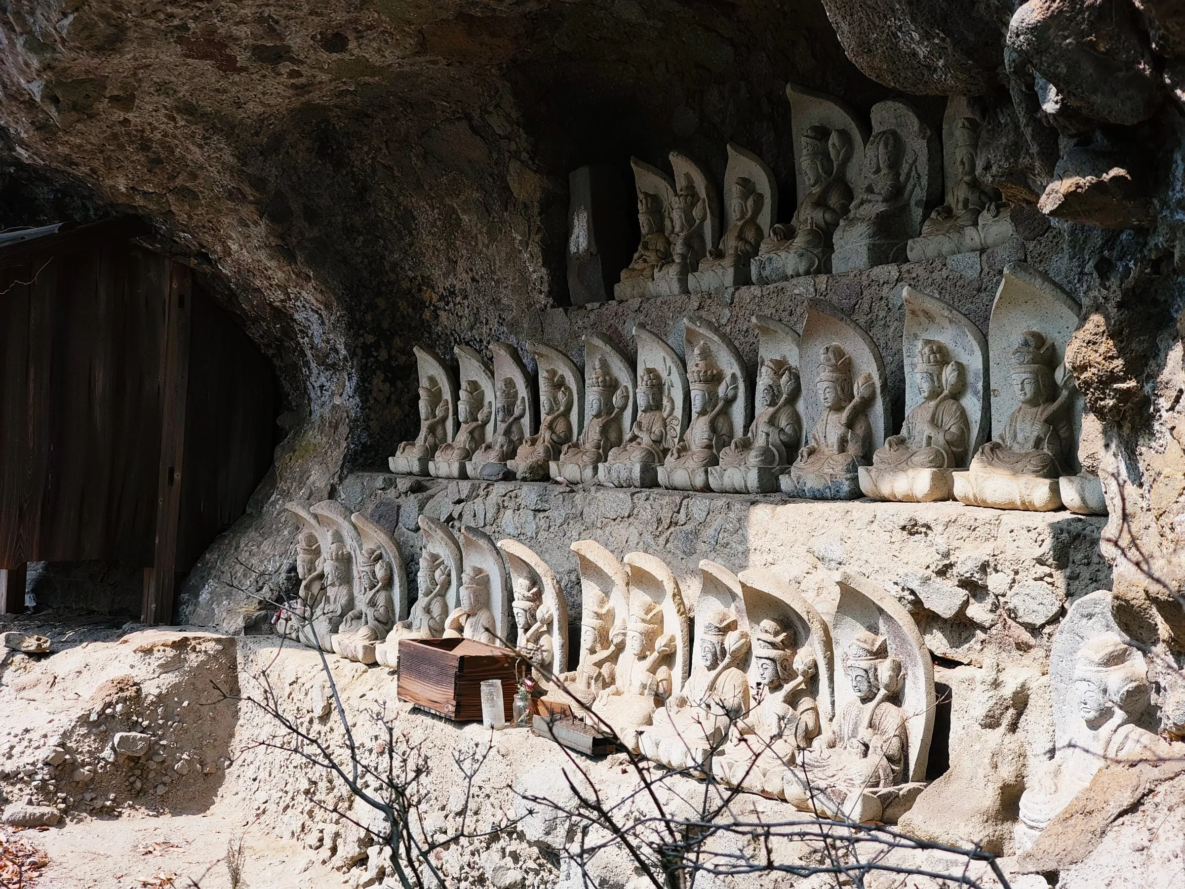
For over a thousand years, mountain monks on the Kunisaki Peninsula have walked between its temples, caves and rock pinnacles in a practice called mine-iri. The Kunisaki Peninsula Minemichi Long Trail — also known as the Kunisaki Peninsula Long Trail or simply the Kunisaki Trail — follows their path through the temples of Rokugo Manzan, a unique blend of Buddhism and Shinto. This guide brings together the official maps and the records of hikers who walked it.
- Distance
- approx. 125 km
- Sections
- 10
- Days
- 4–6 days
- Total ascent
- approx. 6,200 m
- Start / finish
- Kumano Magaibutsu (Bungotakada) → Futago-ji Temple (Kunisaki)
- Best seasons
- Late March – early May / late October – early December
- Difficulty
- Moderate to hard: constant climbs and descents, with rocky sections and chains
- Terrain
- Volcanic rock ridges and satoyama farmland, with many paved and forest-road stretches
How long is the Kunisaki Long Trail?
About 125 km in 10 sections — but you will see different numbers depending on the source:
- 122.9 km — official trail map, 2023 edition (the distances used in this guide's section pages)
- 125.5 km — the table on the official website (the basis for "about 125 km" here)
- 133.2 km — the older official pamphlet
The differences come mainly from route changes and measuring: section K-2 was shortened from 17.6 km to 8.9 km in the 2023 map, and sections T-4, K-3 and K-6 are listed with slightly different lengths. Tour companies and travel sites quote other figures again. Plan with about 125 km, and allow extra for detours to stations, inns and hot springs.
How will you walk it?
Before you plan
- Wild camping is not allowed on the trail. Stay at campsites or lodgings.
- Some sections are dangerous in the rain. Do not walk the Nakayama Senkyo ridge on T-4 (chains, narrow ridges) in bad weather.
- Public transport is very limited, and there is almost no way back to town from the finish at Futago-ji. Always check Access.
More notes
- Reliable water sources are few. Plan to carry a full day's water.
- Cooking with fire and smoking are prohibited in the mountains.
- On T-2, the section between Watatsumi Shrine and Nameshi Dam is under construction until 30 December 2026, with a detour (Bungotakada City).
Tips for international hikers
Getting there
Oita Airport sits on the peninsula itself, with domestic flights from Tokyo (Haneda and Narita) and other cities. By rail, JR Usa Station on the Nippo Line is the gateway on the west side. The hot spring town of Beppu makes a good base before and after the walk.
Language
Little English is spoken in the villages along the trail. Keep a translation app handy, and show the Japanese place names in this guide to taxi drivers and locals.
Cash
Small shops, guesthouses and temple entrance fees are often cash only. There are few ATMs on the peninsula; withdraw yen beforehand (7-Eleven and Japan Post ATMs accept foreign cards).
Booking lodging
Places to stay are few and far apart, and many small inns take bookings by phone in Japanese only. Book well ahead, and ask your hotel or a Japanese-speaking friend for help if needed.
Temples and hot springs
Many temples charge a small entrance fee. Take off your shoes in halls and follow signs about photography. At hot springs, wash before entering the bath; swimsuits are not worn, and some baths may refuse guests with tattoos.
Nature and safety
There are no bears in Kyushu, but you may meet wild boar and monkeys. Watch for venomous mamushi snakes and, in late summer and autumn, hornets. In an emergency, call 119 (ambulance) or 110 (police).
Route map
The route is colour-coded by section, with lodging, water, food and hot springs. Use the button at the top right of the map to show toilets, temples and more. Tap a marker for details and a link to Google Maps.
Click the map to zoom with the mouse wheel.
Open in Google My Maps (Japanese) ↗Official course map (Japanese) ↗
Elevation profile
About the data in this guide
This guide is based on a database compiled by the author from the official trail map (2023 edition), the official website (kunisakihantou-trail.com), Bungotakada City, Yama-kei Online, and hikers' records on YAMAP and personal blogs. Facility information comes from other hikers' reports and may have changed.
The total distance differs between sources. This guide uses "approx. 125 km", based on the total of the table on the official website (125.5 km). Distances between points use the 2023 official map (about 123 km in total).
| Section | 2023 map | Official website | Old pamphlet |
|---|---|---|---|
| T-1 | 11.5 | 11.5 | 11.5 |
| T-2 | 15.2 | 15.2 | 15.2 |
| T-3 | 12.2 | 12.2 | 12.2 |
| T-4 | 10.3 | 11.5 | 10.3 |
| K-1 | 11.2 | 11 | 11.2 |
| K-2 | 8.9 | 8.9 | 17.6 |
| K-3 | 12.5 | 15.5 | 15.5 |
| K-4 | 13.4 | 13.4 | 13.4 |
| K-5 | 14.3 | 14.3 | 14.3 |
| K-6 | 13.3 | 12 | 12 |
| Total | 122.9 | 125.5 | 133.2 |
Related stories: Four Days on the Kunisaki Peninsula Minemichi Long Trail — A Walk I Didn't Finish / The Kunisaki Peninsula: Japan's Other Ancient Pilgrimage Trail